
Washington Draws a Line
In October 1884, 41 delegates from 25 nations gathered in Washington, D.C., to settle an argument that every map had already been making. The International Meridian Conference placed a proposal before them: the meridian passing through the centre of the transit instrument at the Observatory of Greenwich would become the initial line for longitude. The proposal named Greenwich’s transit instrument as the world’s starting meridian.
The Airy Transit Circle had been erected for Sir George Biddell Airy, the seventh Astronomer Royal, and it supplied the historic Greenwich reference later marked for visitors. The Airy Transit Circle was the observatory instrument behind the historic meridian.Latitude came with an anchor in the Equator, a line created by Earth’s shape. Longitude depended on agreement. Mapmakers had used national observatories, the island of Hierro in the Canaries and St Paul’s Cathedral in London, because longitude has no equivalent natural point of origin. A meridian could run from pole to pole through any place that won enough support.
Their proposed system counted longitude east and west from Greenwich to 180 degrees, while a universal day would begin at mean midnight on the chosen line. The conference put both rules into its resolutions. Railways and telegraph networks had made that shared reference urgent, since schedules and messages now crossed places whose clocks still followed separate suns.
President Chester A. Arthur had called the conference after Congress authorised him to invite nations to fix a common prime meridian. The delegates had arrived with rival observatories, rival national habits and a decision that would put one place at the centre of the map. Why did Arthur’s delegates choose Greenwich for a line geography had never supplied?
Arthur’s conference would take more than three contentious weeks to negotiate an international accord on global standard time and a single prime meridian. The delegates spent those weeks working toward a common agreement.
Britain Gives Time a Signal
British towns had long set their clocks by the sun overhead, and the resulting differences appeared quickly on a journey. At midday in Bristol, clocks showed ten past twelve in London, only about 100 miles to the east. The two cities kept those distinct local times, each one reflecting the sun’s apparent passage over its own longitude.
Railways made those local minutes expensive to manage. A timetable had to tell passengers, station staff and freight operators when a train would arrive at every stop, while every town carried its own noon. The rapid expansion of railways and communications networks during the 1850s and 1860s made a standard global time essential. Britain had already begun building one from Greenwich.
The Royal Observatory sent time telegraphically, giving railway companies a way to receive the same signal far from Greenwich. The Observatory began transmitting time through the telegraph.
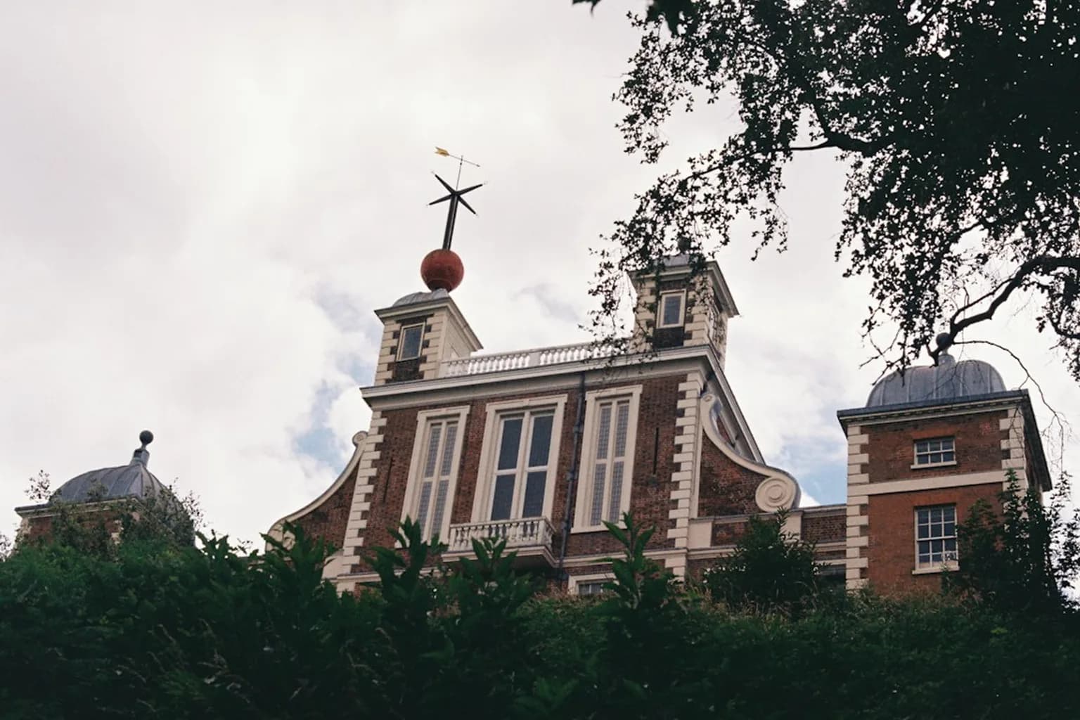
A red ball on top of Flamsteed House at the Royal Observatory had dropped at 1 p.m. since 1833. The ball gave London a public signal of Greenwich Mean Time, visible at a precise moment each day. It was the first public time signal for GMT.
The Great Western Railway put its stations on Greenwich Mean Time in 1840, choosing one clock for a network that crossed many local times. By early 1848, Britain ran on a single clock, the first country to do so.
John Henry Belville carried the same instruction through London in a chronometer set to the Observatory’s master clock. Belville, an Observatory assistant, took the instrument around the city and sold accurate time to subscribers. His customers paid for Greenwich time delivered by hand. The red ball, the telegraph and Belville’s chronometer made Greenwich useful before diplomats ever considered making it universal.
America Fills Its Stations With Clocks
North America faced the railway problem on a larger scale. By the middle of the 19th century, the continent had 144 official local times. Each town’s clock made sense within its own streets, while a railway line connected places whose minutes drifted apart as the train moved.
One railway guidebook made the problem legible by publishing the local times in approximately one hundred American cities against noon in Washington. The guidebook set city clocks beside Washington noon. Its readers could see how many separate calculations a journey demanded before a train had even left the station.
Railway stations in the 1870s displayed that confusion in public. Their clocks reflected the separate time standards of lines including the Erie Lackawanna, the New York Central and the Baltimore & Ohio. Philadelphia time stood twenty minutes ahead of Pittsburgh time. A station clock could therefore identify a railway company as much as a city, leaving passengers and staff to translate between competing systems.
Charles F. Dowd put the case for reform before North American railways in 1870. His proposal sought a smaller number of shared zones, giving trains a schedule that would keep its meaning across long distances. Dowd first raised the need for change in the railways that year.
Dowd’s early scheme divided the country into four zones centred on the Washington meridian. He proposed four railway zones around Washington.
Sandford Fleming gave the railway idea a global frame. In 1879, he published “Time-Reckoning and the selection of a prime meridian to be common to all nations,” arguing for a common reference and a clearer system for reckoning time. Fleming’s paper connected world time with the choice of a prime meridian. He proposed 24 standard time zones, each one hour apart.
Fleming had already made his preference clear when he proposed that a consistent worldwide treatment of time should use Greenwich rather than Washington’s meridian. He put Greenwich ahead of Washington for a global system.
Fleming called his original single, universal 24-hour clock “Cosmic Time” or “Terrestrial Time.” Those names appeared in Fleming’s scheme for world time.
North American railways acted before governments supplied a law. At noon on 18 November 1883, they switched to a simplified time system at the 75th Meridian. The railways made their change at that fixed noon, showing that a commercial network could establish a shared rhythm across a continent.
Greenwich Arrives With an Advantage
Fleming’s paper also gave the delegates a reason to look toward Britain. It found that 95.5% of the world’s ships used eleven main meridians, and Greenwich served 65% of those ships. Measured by tonnage, Greenwich’s share rose to 72%. The figures showed Greenwich already leading the world’s navigators, whose charts needed a fixed line for calculating position at sea.
Every ship that used a Greenwich chart carried the line into the practical work of navigation. A navigator needed a shared starting point to calculate longitude, and the chart supplied one before any international agreement required it.
That maritime habit joined the British railway system at the Observatory. A ship’s chart, a railway timetable and a telegraphed time signal already used Greenwich as a reference. The conference did not have to persuade captains and British train companies to abandon an unfamiliar method. It had to decide whether an existing method could become a common one for countries with their own maps and their own claims.
Washington, Berlin and Paris stood among Greenwich’s key rivals, each representing a different national centre from which a world map might have been measured. The conference faced those established rivals to Greenwich.
France suggested a meridian through the Canaries, while Italy gave particular support to Jerusalem. Both alternatives reached the conference debate. Other candidates carried their own appeal because every meridian gave one place the privilege of being zero, then made every other place east or west of it.
Professor Piazzi Smyth, Astronomer Royal for Scotland, made the arbitrariness plain with a question of his own: “If there had to be a common prime meridian, why not the Great Pyramid in Egypt?” Smyth offered the Great Pyramid as a possible starting point. A line on a globe gained power through use and agreement, which made every proposed location a political choice.
Astronomers in Bologna also wanted Jerusalem, while a geographer in Geneva proposed a line through the Bering Strait between Russia and the United States. The Bering Strait entered the argument as another possible route for zero. The candidates stretched from Egypt to Jerusalem and the Pacific passage between two nations, each offering a different centre for the same shared world.
Greenwich also stood within a British Empire that ranked among the dominant empires of the period. The Prime Meridian emerged during that era of British power. The delegates could see the political weight of the choice alongside the charts and railway clocks that made Greenwich convenient.
One historian of time zones, cited in an account of their continuing disputes, put the point plainly: “Time zones are about politics.” The account describes time zones as political arrangements. Smyth’s Great Pyramid question had exposed the same condition before the delegates cast their votes.
The Vote in Washington
The conference considered the proposal to place the initial meridian through Greenwich’s transit instrument, then brought the question to a vote. Greenwich won by 22 votes to one. San Domingo cast the sole vote against, while France and Brazil abstained. The ballot gave Greenwich its overwhelming formal victory, although the abstentions preserved France’s and Brazil’s distance from the choice.
The delegates paired the line with a new shared rule for time. Greenwich Mean Time would serve as the standard for the world, the day would begin at midnight at Greenwich, and the day would be counted on a 24-hour clock. The agreement established GMT, Greenwich midnight and the 24-hour day together. A decision about longitude had become a decision about when each day began.
Longitude would run in two directions from Greenwich, with east longitude marked plus and west longitude marked minus, each extending to 180 degrees. The conference stated that system in its proposed resolutions. Maps and navigators now had a common way to describe the same positions, while timekeeping had a common starting point.
France retained its attachment to Paris time even after Washington. A bill introduced in the French Chamber of Deputies in 1896 proposed Greenwich Mean Time as legal time, with Paris Mean Time reduced by nine minutes and 21 seconds. The measure became law in France in 1911. The Washington result had set the framework, while countries continued to bring their own political and legal choices to the clock.
The Clock Leaves the Observatory
The transit instrument at Greenwich had provided a physical line for the 1884 agreement, and the historic Prime Meridian remains marked there at longitude 0° 0′ 00″. It runs from pole to pole, crossing the United Kingdom, France, Spain, Algeria, Mali, Burkina Faso and Ghana. That historic line still gives visitors a visible Greenwich zero.
Timekeeping gradually shifted away from observations at the observatory. Atomic clocks have kept the world’s time since the 1960s, replacing astronomy as the source of precision. Atomic clocks have governed world time since that decade. The shared clock that railways and diplomats wanted now depends on instruments far removed from the transit circle named in Washington.
On 1 January 1972, Coordinated Universal Time became effective internationally. UTC runs at the rate of atomic clocks, with leap-second adjustments when the difference between atomic time and Earth-based time approaches one second. UTC joined atomic time to the rotating Earth, carrying forward the old need for a clock that the wider world could share.
The answer to Arthur’s delegates lies in the advantage Greenwich had already accumulated. Its charts guided a large share of shipping, its signals ran through British railway networks, and its time had already organized Britain around one clock. The 22-to-one vote made that practical advantage a worldwide convention, even as later systems refined the location of zero.
GPS’s World Geodetic System 1984 places the modern Prime Meridian 100 metres east of Greenwich Observatory. A person standing on the historic Greenwich line stands 100 metres west of GPS zero.





Comments (0)