
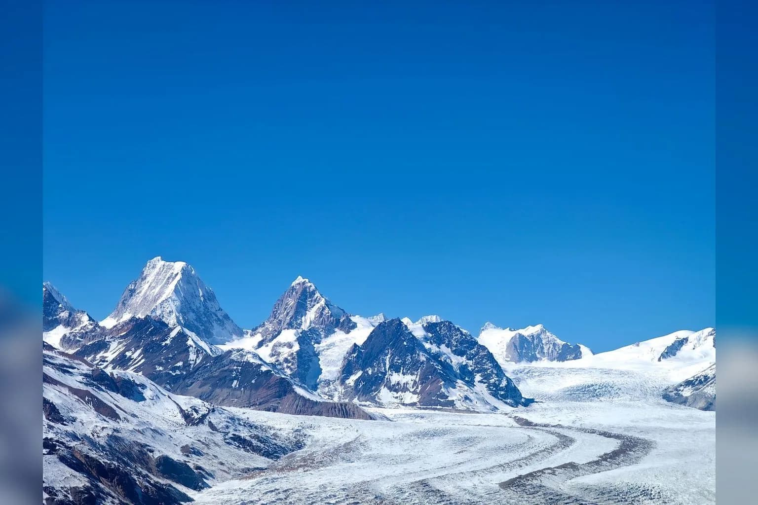
When a Glacier Lake Broke Loose, the Valley Felt the First Phase
On May 7, a lake formed by melting ice at Pakistan’s Shisper Glacier burst through an ice dam and sent a torrent of water and debris into the valley below. The flood swept across fields and houses, wrecked two power plants, tore away sections of the main highway, and washed out a bridge connecting Pakistan and China, as Yale Environment 360 reported. In a few hours, water that had been held high in the mountains became a force that rearranged daily life downstream.
The immediate cause lay in the lake and the dam that contained it. The larger story begins with the conditions that filled it: record temperatures in March and April hastened melting at Shisper, in Gilgit-Baltistan, feeding the accumulation of water behind the ice barrier, according to Yale Environment 360. Once that barrier gave way, the valley received the first consequence of a faster melt cycle in its most physical form: too much water moving too quickly, carrying debris with it.
That sequence matters because melting ice does not arrive downstream as a quiet, gradual change. It can gather in a lake, press against a natural dam, and release suddenly into the routes people use to travel, grow food, and keep the lights on. Shisper turned an abstract measure of warmer months into flooded homes, damaged infrastructure, and a broken connection across a national border.
The event also offers a clear starting point for the water story ahead. A warming mountain system can deliver an early period of dangerous abundance, as accelerated melting pushes more water into places built around rivers and valleys. The damage at Shisper shows why the first question is often immediate: where will the extra water go when the mountains release it?
The ‘Third Pole’ Feeds Rivers Far Beyond the Mountains
That question begins with the size of the mountain system releasing the water. The Hindu Kush Himalaya stretches for more than 2,000 kilometers across Asia, reaching through Afghanistan, Bangladesh, Bhutan, China, India, Nepal, and Pakistan, according to the National Academies. Over a relatively short horizontal distance, the region rises from the alluvial Indo-Gangetic Plain near sea level toward heights of about 8,000 meters, creating an immense high-altitude store of snow and ice above some of Asia’s most densely used river corridors.
That store is why the Hindu Kush Himalaya is known as the world’s “Third Pole.” The name reflects the sheer concentration of ice in these mountains, which hold the world’s greatest collection of glaciers after the Arctic and Antarctica, as a World Bank report puts it. Across the wider Himalayan-Karakoram-Hindu Kush region, researchers count 54,252 glaciers spread over 60,054 square kilometers. Those glaciers sit high above river headwaters, where snow and ice become flowing water and carry the mountain system into the plains.
The Indus, Ganges, and Brahmaputra are among the great rivers that begin in this high country. Together, their systems carry water to more than a billion people, according to Yale Environment 360. The wider Himalayan glacier system feeds 10 river networks, providing water to more than 210 million people in the mountains and roughly 1.3 billion people downstream, the World Bank report estimates. A change that begins at a glacier’s edge therefore enters a much larger human landscape as river water.
That reach gives the phrase “Third Pole” its practical meaning. The region’s ice belongs to high peaks and remote valleys, yet the water it supplies moves through systems shared by cities, farms, and mountain communities across several countries. Each river carries that mountain water in its own way, shaped by where it rises and what feeds it along the route. The next part of the story lies in those differences.
Every River Has Its Own Dependence on Ice
Those differences begin with the share of mountain water each river actually carries. In the upper Indus, snow and ice melt make up as much as 72 percent of river runoff, according to Yale Environment 360. The Ganges and Brahmaputra draw a far smaller share from the same source, with snow and ice melt accounting for between 20 and 25 percent of runoff. That spread changes the meaning of a warming glacier from basin to basin: a shift in melt carries particular force in the upper Indus, while the Ganges and Brahmaputra arrive at the lowlands after gathering water from a broader mix of sources.
Season adds another layer. Glacial meltwater’s contribution varies across the Hindu Kush Himalayan region and varies sharply through the year, the National Academies has found. High valleys feel that timing closely, because melt matters most in the west and at higher elevations. There, the annual movement from snowpack and glacier into stream can shape the water available to communities living nearest the ice. In Nepal, modeling of tributaries to the Ganges found glacier-melt contributions ranging from about 20 percent in the Budhai Gandaki basin to about 2 percent in the Likhu Khola basin, an illustration of how much the picture can change within a single country and river network.
Geography helps explain the variation. The Sutlej Valley serves as a rough dividing line between the eastern and western Hindu Kush Himalaya, according to the National Research Council. Summer monsoons dominate precipitation at the eastern end of the region, while winter mid-latitude westerlies dominate at its western end. Lower elevations often depend primarily on monsoon rains, and the National Academies says glacier retreat over the next several decades is unlikely to cause significant changes in water availability there. At high elevations, however, continued retreat could alter streamflow in some basins.
That distinction keeps the water story grounded in place. A farmer or household downstream from a monsoon-fed reach lives with a different mix of pressures than a community beside an ice-fed upper river, even when both sit within the same vast mountain system. The ice still matters throughout the region, and researchers expect snow and glacial melt to remain important water sources. Its role, however, comes through particular rivers, particular elevations, and particular seasons. Those local patterns will determine where a growing pulse of meltwater first becomes hardest to manage.
More Meltwater Brings a Volatile Decade Before It Brings Scarcity
Its role, however, is already changing the rhythm of water in the high mountains. Researchers expect meltwater to increase until around the 2050s, sending a larger seasonal pulse through valleys where rivers already move quickly between steep slopes and settled land, according to Yale Environment 360. That rising pulse creates a difficult near-term reality: more water can look like a stronger supply in one moment and become a destructive force in the next, especially when it gathers behind unstable natural barriers.
For people living upstream, glacial lake outburst floods and landslide lake outburst floods rank as the dominant physical hazards, a study chaired by Henry Vaux found. The names describe two versions of the same urgent sequence. Water collects in a lake, a barrier fails, and the stored volume races downhill. In a landscape shaped by snow, ice, rock, and narrow river corridors, the danger lies in the speed with which stored water can turn into moving water. Higher melt adds pressure to that landscape by increasing the volume available to feed lakes and rivers through the coming decades.
The risk also arrives at a moment when the mountains are becoming a major construction zone. Around 650 hydro projects are planned or underway at high-altitude sites across the region, many located close to glaciers or glacial lakes, Yale Environment 360 reports. Those projects are being built in the same terrain where water conditions can shift rapidly from a manageable flow to a flood hazard. Their location ties decisions about power generation directly to the changing behavior of ice, lakes, and mountain rivers.
That connection gives the next few decades a particular kind of volatility. Communities and planners will contend with increasing meltwater while managing the hazards that accompany it, and they will do so alongside an expanding network of high-altitude infrastructure. The water moving off the mountains therefore carries two demands at once: it remains a valuable flow for river systems, while its sudden concentration can threaten the valleys and projects built in its path. The question is already less about whether meltwater matters than about how safely a region can live with a larger and less predictable pulse of it.
After the Peak Comes a Smaller Ice Reservoir
Meltwater remains a valuable flow for river systems, while its power grows precisely as the reservoir behind it contracts. Himalayan glacier area has already shrunk by 40 percent since the Little Ice Age maximum, which occurred between 400 and 700 years ago, and ice melt has accelerated in recent decades faster than in other mountainous parts of the world. That history gives the coming surge in meltwater its real meaning: each season of abundant flow also draws down the stored ice that can sustain future seasons.
The pace will differ from valley to valley, shaped by elevation, snowfall, temperature, and the scale of each glacier system. Yet the regional direction is clear. Depending on the level of global warming, studies project that at least another third and as much as two-thirds of the region’s glaciers could vanish by the end of the century. A glacier can release more water as warming first intensifies melt, then yield less once its ice mass has thinned and retreated. The transition turns a familiar source of seasonal water into a dwindling reserve.
That reserve matters most acutely where communities live close to the ice and where rivers draw heavily on snow and glacier melt. It also reaches downstream, through river systems whose flows connect high mountain catchments with farms, towns, and cities far from the glacier margins. Researchers expect meltwater to increase until around the 2050s and then begin to decline, placing the peak-water period in the middle of decisions now being made about roads, power, irrigation, and settlement.
The shift after that peak will arrive as a change in timing as well as volume. Spring and summer flows depend on a store of snow and ice accumulated over many seasons; when that store becomes smaller, the buffer it provides becomes smaller too. For high mountain communities, the question moves from managing powerful water to planning around a less dependable supply. For downstream systems, the same change adds another moving part to rivers already shaped by seasonal patterns and rising demand.
The central challenge therefore stretches across decades. The flood phase creates urgent damage and difficult infrastructure choices, while the later phase asks communities to live with the consequences of a reduced ice reservoir. Water will keep coming off the mountains, though the conditions governing that flow will keep changing.
Irrigation Timing Is Where Glacier Change Meets Breakfast
Those changing conditions reach the farm through the irrigation channel, where the question is often whether water arrives when a crop needs it. Snowmelt supplies irrigation, and unpredictable shifts in its timing have already led some farmers to abandon their fields, according to Yale Environment 360. A field can therefore sit at the meeting point of two different water problems: floodwater can tear through land in one season, while a later disruption in the usual meltwater schedule can make irrigation harder to rely on.
That distinction matters because farming runs on calendars as much as quantities. Water delivered at the wrong moment can leave a grower facing damage, delay, or a missed irrigation window, even when the wider river system still carries substantial flow. The effect changes from place to place. Research summarized by the National Academies finds that glacier melt’s contribution to water supply varies across the Hindu Kush Himalayan region and across seasons; at lower elevations, water availability over the next several decades depends primarily on monsoon rains. For high-elevation areas, continuing glacier retreat could alter streamflow in some basins.
Farmers are also working within a water system shaped by pressures far beyond the ice. Groundwater is already being depleted, with evidence of overdraft in the central Ganges Basin, and researchers say overdraft could affect water supplies earlier and more heavily than foreseeable changes in glacier meltwater, according to a study chaired by Henry Vaux. Growing human water use adds another demand to that constrained supply, while shifts in the location, intensity, and variability of rain and snow are likely to carry greater consequences for regional water supplies than glacial retreat alone, the National Academies reports.
So the agricultural story turns on reliability. A changing mountain melt schedule can unsettle irrigation, depleted groundwater can narrow the room for adjustment, and changing rain and snow can redraw the seasons on which planting depends. The water that reaches a household’s food supply has already passed through all of those decisions and uncertainties before it reaches the field.
The Same Water That Runs Turbines Can Wreck Them
That same water also enters the household through the power line, and at Shisper it showed how quickly a mountain river can turn from an energy source into a threat to the machinery built along its course. When the glacier lake burst through its ice dam on May 7, the torrent of water and debris that swept down the valley damaged two power plants along with fields, homes, the main highway, and the bridge connecting Pakistan and China, as Yale Environment 360 reported. For a power plant, the river is both fuel and force: its flow drives generation, while debris-laden floodwater can batter the facilities meant to harness it. Shisper made that tension immediate, turning a changing water system into a disruption of electricity itself.
That exposure matters because hydropower is expanding into the same high-altitude landscape where glaciers and glacial lakes shape the timing, volume, and behavior of the water. Around 650 hydro projects are planned or already underway across the region, many located close to glaciers or glacial lakes, according to Yale Environment 360. Each project ties an expensive piece of public infrastructure to a river whose conditions can shift sharply with the mountain environment upstream. A plant needs water arriving in a workable pattern, through channels and intakes that can withstand the sediment, debris, and sudden surges that mountain flows can carry. The same location that offers steep terrain and fast-moving water can therefore concentrate operational risk at the point where electricity is supposed to begin.
The stakes extend well beyond the sites themselves. The Himalayan-Karakoram-Hindu Kush region contains 54,252 glaciers across 60,054 square kilometers of glaciated area, a vast water store connected to major river basins and to the power systems developing around them, according to a World Bank report. Across South Asia, 500 million people lack energy access, the same report says, which gives every damaged facility and every uncertain generating season a household dimension. Electricity can mean light, refrigeration, communication, and the basic ability to plan a day around services that remain available. Water volatility complicates that planning from both directions: powerful flows can damage the infrastructure that depends on them, while a changing supply forces operators and communities to live with a less predictable foundation for power.
A Glacier’s Change Becomes a Household Problem Through Water, Crops, and Power
That gives every change in the mountains a direct bearing on daily life, because water moving off the ice eventually arrives as irrigation, electricity, and the flow of the rivers that connect high valleys to heavily populated plains. Rising temperatures hasten melting, and the first result can be an enlarged, less predictable volume of water moving through steep terrain. For communities upstream, glacial lake outburst floods and landslide lake outburst floods rank as the dominant physical hazards, while farther downstream changing monsoon rainfall and cyclones carry greater weight in the central and eastern Himalayas, according to a regional assessment chaired by Henry Vaux. The same water can reach a field as a destructive flood, then arrive at the wrong time for irrigation after the immediate danger has passed.
That timing matters because rivers draw on ice, snow, rain, and groundwater in very different proportions. In the upper Indus, snow and ice melt supply as much as 72 percent of river runoff; the comparable range for the Ganges and Brahmaputra is between 20 and 25 percent, as Yale Environment 360 reports. Those figures make the western, high-elevation basins especially exposed to changes in frozen water, while monsoon rains shape a larger share of the picture farther east and at lower elevations. The regional response therefore has to follow the character of each basin rather than treat the Himalayas as one uniform water system.
For now, the shift runs in two directions at once. Meltwater is expected to rise until around the 2050s, bringing more water into river systems already vulnerable to sudden surges; after that point, the flow is expected to decline as the ice reservoir becomes smaller, according to Yale Environment 360. Farmers experience the change through the reliability of irrigation water, and power systems experience it through the volume and volatility of the rivers that turn their turbines. Around 650 hydro projects are planned or underway at high altitudes across the region, many close to glaciers or glacial lakes, a placement that ties energy planning closely to the changing mountain water cycle.
The practical question is therefore larger than how fast a glacier recedes. It is how households, farms, and power networks manage water that first arrives with dangerous force and later becomes less dependable. Researchers also point to groundwater depletion, rising human water use, and shifts in the location, intensity, and variability of rain and snow as pressures likely to shape regional water supplies, the National Research Council found. Glacier loss sets this moving sequence in motion, and its second act will unfold wherever a river is expected to provide food, power, and a dependable supply of water.


Comments (0)